Ras Muhammad National Park
Snorkeling, nature reserves, parks, coral reefs, protected area
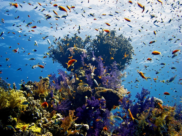
Ras Mohammad (Egyptian Arabic: راس محمد Rās Maḥammad , is a national park in Egypt at the southern extreme of the Sinai Peninsula, overlooking the Gulf of Suez on the west and the Gulf of Aqaba to the east.
When the Sinai Peninsula was returned to Egypt, Ras Muhammad was declared for protection from fishing and other human activities. Some of the fishing methods, such as using dynamite and knives also were impacting the coral reef and the fish populations. In 1983, the Egyptian Environmental Affairs Agency (EEAA) established the area as a marine reserve for the protection of marine and terrestrial wildlife. The park was also established to protect against urban sprawl from Sharm El Sheikh and other coastal development. The name literally means “Mohammad’s Head”, where “head” in this instance means “headland”. There is a saying in the area that the name arose because in side view the contour of the cliff looks like the profile of a bearded man’s face, with horizontal hard strata providing the nose and bearded chin.
The park is situated in the tourist region of the Red Sea Riviera, located 12 km from the city of Sharm El Sheikh. The park spans an area of 480 km², including 135 km² of surface land area and 345 km² area over water. Marsa Bareika is a small bay inlet in Ras Mohammed, and Marsa Ghozlani is a very small inlet located across from the park visitors center.
Winch parts visible on the wreck of the SS Thistlegorm, which sunk off the coast of Ras Muhammad
Ras Mohammad encompasses two islands, Tiran and Sanafir. Tiran Island is located approximately 6 km offshore from the Sinai Peninsula. Underwater caves formed as the result of earthquakes are located in Ras Mohammad.
About 0.9 hectare of mangrove forest cover a 1.15 km shallow channel at the southernmost end of Ras Mohammad peninsula. Near the mangrove and approximately 150 m inland, there are open cracks in the land, caused by earthquakes. One of the cracks is approximately 40 m length and 0.20−1.5 m in width. Within the cracks, there are pools of water, some with a depth of over 14 m.
The inland area includes a diversity of desert habitats such as mountains and wadis, gravel and coastal mud plains and sand dunes. The area also plays a role in bird migration, serving as a place of rest and nourishment.
Climate
Ras Mohammad National Park experiences a very dry climate, with only minimal rainfall during the winter. During the summer, temperatures often exceed 40°C (104°F) and low temperatures around 27°C (81°F). Temperatures are mild during the winter, with daytime high temperatures averaging around 23°C (73°F) and low temperatures 14°C (56°F)